Viewing entries tagged
Disaster Relief

Nepal: Where is help needed most and where is it being given?

Comment

Nepal: Where is help needed most and where is it being given?

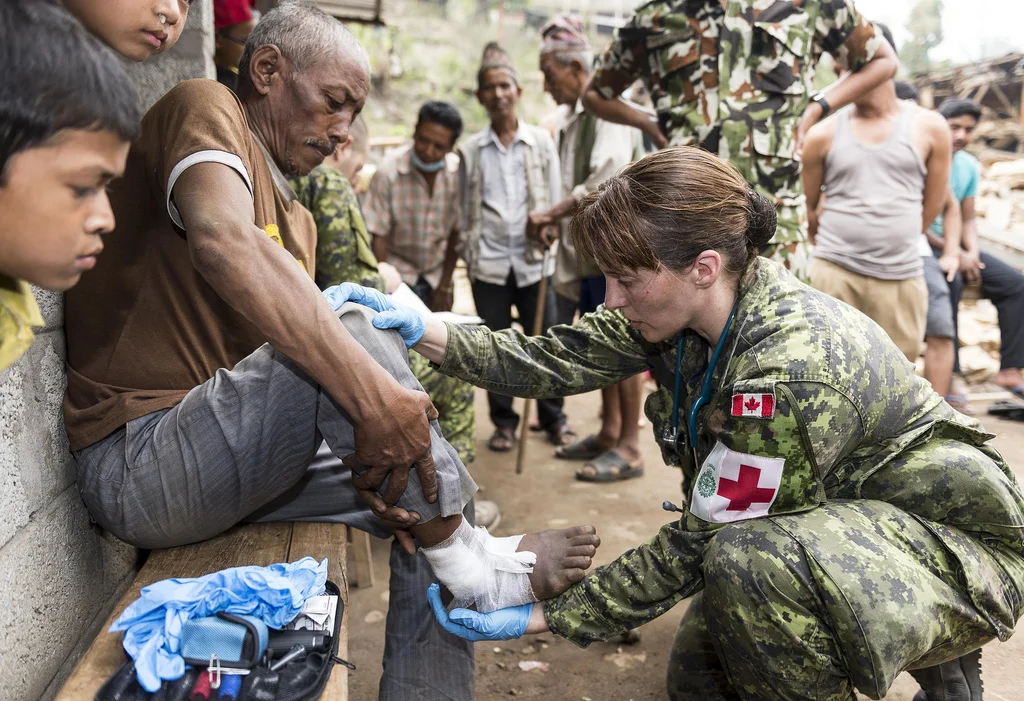
Canadian Disaster Assistance Response Team (DART) Provides Aid to Remote Areas of Nepal

As aid agencies and nonprofits pour into Kathmandu in hoards from around the world and millions if not billions of dollars have been donated, one must begin to wonder where is aid truly needed the most? Where are the people who are trapped and whose supply routes have been severed by destruction? The Canadian Disaster Assistance Response Team, or DART as it is more commonly known, is seeking to find just those people in those remote areas.

Nepal is a country that is nearly impossible to navigate in normal circumstances, especially for non-locals. But with landslides and rubble now everywhere, this has become an even greater challenge. According to an interview with CBC News Canada, ‘"What we're finding right now is the most affected areas in Nepal are the bordering areas ... the remote areas bordering China," Canadian Red Cross president and CEO Conrad Sauvé said. He added that some of those affected areas can take up to two days to reach, even under good conditions.” The primary fear that those who suffered injuries living outside of Kathmandu can not make it to the clinics, thus are only growing sicker. So DART is hiking to them. By setting up mobile clinics in these remote areas, DART hopes that a greater number of people can be provided with adequate care and supplies before it’s too late.


Picture from Canadian Forces Photos Flickr

Comment

Crowd-Source Mapping and Disaster Relief: How are GPS and satellite images helping Nepal post quake?

Comment

Crowd-Source Mapping and Disaster Relief: How are GPS and satellite images helping Nepal post quake?

As humanitarian organizations flock to Nepal after the devastation of two earthquakes, one organization is making waves through the work of thousands of people from thousands of miles away. You might assume that this work is being done through monetary donations, but rather it is through donations of time and attention. OpenStreetMaps is described as a project to create a free and open map of the entire world, built entirely by volunteers surveying with GPS, digitizing aerial imagery, and collecting and liberating existing public sources of geographic data. The information in OpenStreetMap can fill in the gaps in base map data to assist in responses to disasters and crisis. As the OSM wiki page states: When there is a humanitarian crisis, such as the Nepal earthquake, OpenStreetMap (OSM) volunteers from around the world rapidly digitize satellite imagery to provide maps and data to support humanitarian organizations deployed to the affected countries. It is the largest crowd sourced mapping project on the internet and the need for it only continues to grow.

OSM gained much popularity and attention while working in Haiti after the January 2010 earthquake. The goal is not only to create better and more accurate maps after disasters, but to be better prepared for future disasters and thus reduce the threats they pose. As the Humanitarian OSM Team (HOT) states, “Nobody would argue that data preparedness is better than a scramble after an event.”

Since the first earthquake occurred on April 25th, 2015, OSM reports that 4,826 citizen mappers have made 113,141 changes to the map.These OSM volunteers help to create accurate and detailed maps that include roads, villages, important landmarks, and areas most affected.  By partnering with relief organizations, HOT can use this information to assess where aid is needed most and how to most effectively deliver that aid.

Want to find out more or become an OSM volunteer? Visit the links below:

http://tasks.hotosm.org/project/1030

http://hotosm.org/get-involved

http://hotosm.org/updates/2015-05-01_nepal_earthquake_we_have_maps

Comment